Geography
Dancing Matt
Yakko’s Nations of the World
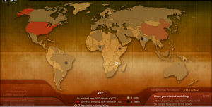
The Breathing Earth
A Flash visualization of world population growth, births, deaths and carbon emissions

A number of different geography games related to locating cities, capitols, and counties around the world.
Virtual Pilot
Click on the map to identify the location of the city which is the plane’s destination.
Stop Disasters!
A disaster simulation game from the UN/ISDR
Mapmsg.com
Statetris is an interesting game mixing aspects of the popular game ‘Tetris’ and geography. Instead of positioning the typical Tetris blocks, you position states/countries at their proper location. Fun, challenging and educational.
Maps.com
Offers a wide variety of map games which allow you to identify counties on various continents.
Test Your Geography Knowledge
Geography location and identification quizzes about the continents and numerous countries throughout the world.
GeoSpy
Test your geosmarts and become a GeoSpy agent by identifying states, provinces, countries, and continents
- Geography Map Match – Learn the locations and shapes of states and countries around the world.
- Geography Capital Catch – Learn the capitals of states and nations around the world.
- Latitude & Longitude Map Game – Practice latitude and longitude concepts with this fun, and fast paced game.
INFORMATIVE
Show Mapping Worlds
More than 140 maps (U.S. and World) based on a wide range of demographic data. Topics include: population, crops, GDP, employment, CO2 emissions, animal resources, etc.
National Geographic’s MapMachine
Looking for geographic facts about a specific country, region, continent, or city? National Geographic’s MapMachine provides a wealth of detailed animated maps. View maps according to physical attributes, such as mineral resources, vegetation, recent and historic earthquakes, natural landscapes, and much more. Other categories include Street Maps, Historic Maps, Atlas Maps, Flags and Facts, Mars, and World Themes.
CIA- The World Factbook
U.S. Central Intelligence Agency site providing annually updated information for every country, including population, geography, religious and ethnic make-up, economic facts, and government and military structure.
Internet subject directories on general and specific topics in geography, including atlases and maps, glossaries, cartography, GIS and GPS, country facts, and climate and weather.
National Geographic
Web site of the National Geographic Society, with articles about issues in global geography. Also a useful resource for maps of many regions.
Perry-Castañeda Library Map Collection
University of Texas collection of up-to-date and historical maps from around the world.
Geography Network
Lets users search for digital maps and other geographic data by selecting a specific region.
Country Profiles
Profiles of countries around the world and links to features on world geography, culture, and history.


Leave a Reply